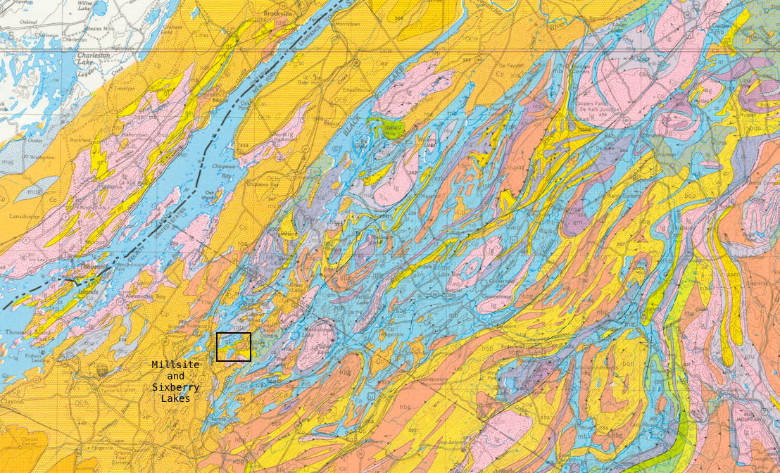
Frontenac Axis
This image from the NY State Geologic Map shows the Frontenac Axis, connecting the Adirondacks with the Canadian Shield. The area containing Millsite and Sixberry Lakes is outlined.They are near the SW edge of the Axis, where it is starting to get covered by early Paleozoic seidimentary rocks. These rocks appear on the map as large areas of the same color, whereas the metamorphic rocks of the Frontenac Axis are elongate blobs generally trending in a NE-SW direction.
View this region within the context of the National Geologic Map here
View a close up of the region around Sixberry Lake here.
This website is intended to collect and display information gathered by folks who visit Sixberry Lake on a regular basis. If you find errors, dead links, etc., or wish to have content removed or modified, please fill out and submit the form here.