Geologic Map of US
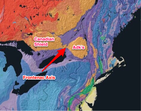
This is part of the Geologic Map of the US, published by the USGS. Most of Canada is underlaiin by the PreCambrian rocks of the Canadian Shield. The Adirondacks (Adk's) are similar rocks of the same age. Connecting the two is a region called the Frontenac Axis. The ancient (1.1 billion years old) metamorphic rocks of the Frontenac Axis are responsible for the Thousand Islands as well as the Indian River Lakes, which include Sixberry.
View the region of the Frontenac Axis on the NY State Geologic Map here
View a close-up of the region around Sixberry and Millsite Lake here.
This website is intended to collect and display information gathered by folks who visit Sixberry Lake on a regular basis. If you find errors, dead links, etc., or wish to have content removed or modified, please fill out and submit the form here.