Original Geologic Map of Alex Bay Quadrangle
The NY State Geologic Map is based on this work done by Cushing and Smyth in 1907 and 1908. This map was part of the New York State Museum Bulletin 145, "Geology of the Thousand Islands Region" available here
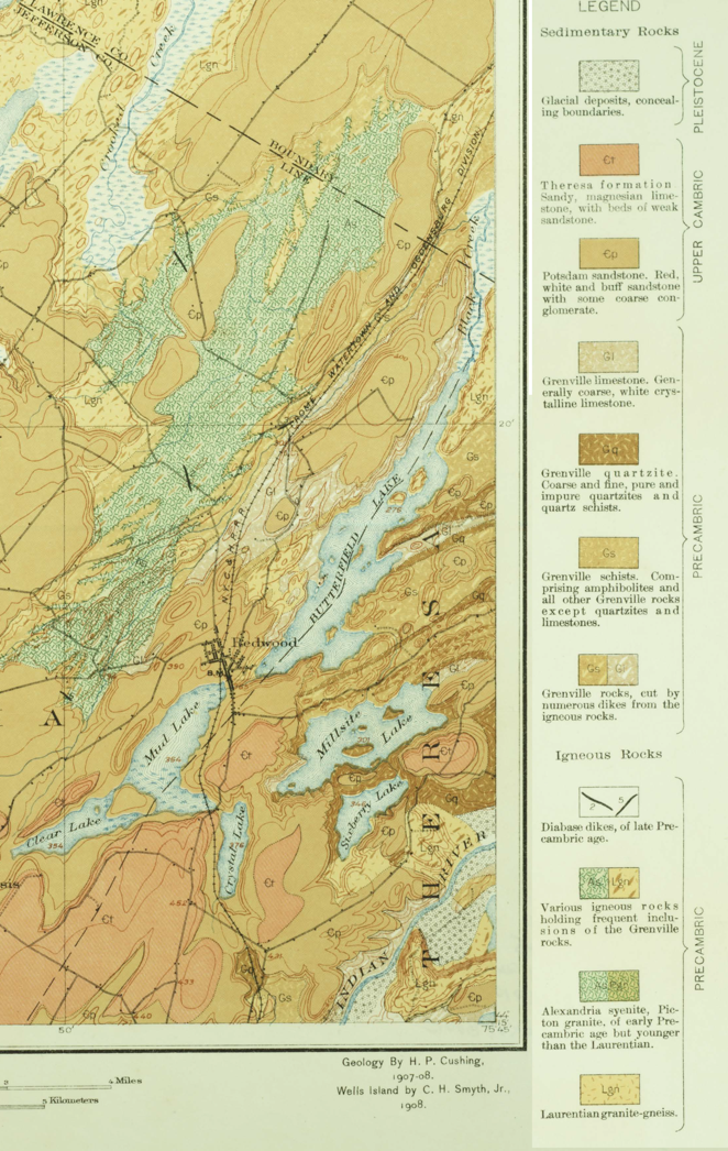
The Potsdam Sandstone is labeled with a Cp (the C has a bar through it) and the Thresa with a Ct (the C has a bar through it) . The underlying metamorphic rocks are labeled Gq (Grenville quartzite) around the northern portion of the lake, and Lgn (Laurentian gneiss) around the southeastern part of the lake. Note that the north and south shores of Millsite, and the north shore of Sixberry are nearly parallel to the striping produced by the various metamorphic rocks north of Millsite.
This map is the basis for the other geologic maps on this website. The geologists who produced it were top notch and the work has held up well for more than a century. You can view and download the whole Bulletin here.
This website is intended to collect and display information gathered by folks who visit Sixberry Lake on a regular basis. If you find errors, dead links, etc., or wish to have content removed or modified, please fill out and submit the form here.